April 2, 2023
MOUNT CHIEF PASCALL STATS
Elevation 2206m high from sea level
Prominence 294m
Elevation gain 1029m
Mount Chief Pascall is located in Joffre Provincial Park area, 26 km east of Pemberton in southwestern BC. It is within Nlháxten/Cerise Creek Conservancy and North of Joffre Peak. Mt Chief Pascall makes a good day hike and it’s best to do it while there is snow on the ground. So after having successfully summited Mt Matier and Joffre Peak about a week or so ago, and with the good weather and snow conditions, it made sense to bag Mt Chief Pascall.
Karlie, Nikita and I drove up from Vancouver at 5:30am and arrived at the trailhead of Mt Chief Pascall at around 8am. We parked our car at the pull out, south of Duffey Highway, geared up with our snowshoes on, and into the forest we went.
The snow line started from the trailhead. The snow was stable allowing us to grip with our snowshoes. The first kilometer was steady with some elevation. Skin and snowshoes tracks were noticeable from the start to a few hundreds meters in where we had to veer off to the left going towards the flat trail of Nlháxten//Cerise Creek Conservancy.
After arriving at the Nlháxten//Cerise Creek Conservancy trail, the sky was clear and the sun was beaming at full blast. We hiked along the flat trail going east for 2.5km, then started ascending up into the woods towards our objective.
At the 3.5km where the elevation began into the woods, there was untouched fresh snow. So we broke trail for about a kilometer until we merged into the snowshoes and ski tracks. From there, it was an easy hike following the tracks.
After hiking for about 2.5 hours and out of the woods, the clouds started to roll in. As we got closer to the ridge of Mt Chief Pascall sky began to clear a bit. Snow was abundant and semi powdery. Took us another 30 minutes (11:30pm) to reach the base of the ridge.
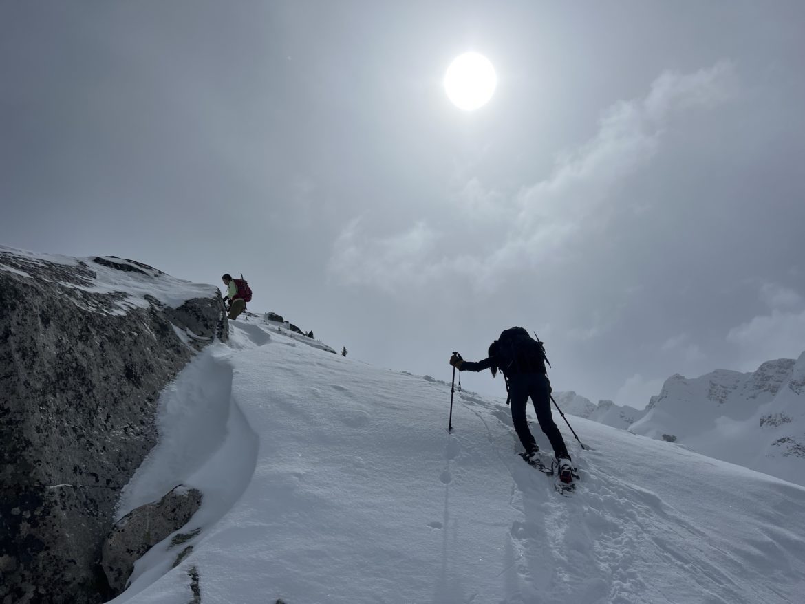
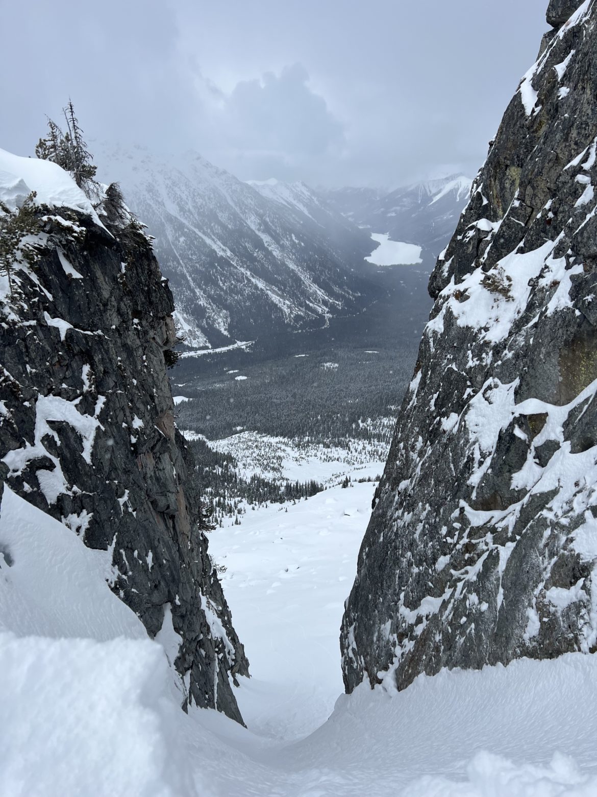
Once at the ridge, we plodding cautiously as some parts of the trail crossings had some loose snow. However, we were greeted with some nice views with the skies clearing a bit. We went past a steep couloir at approx 2010m high. Seems a good place to ski down.
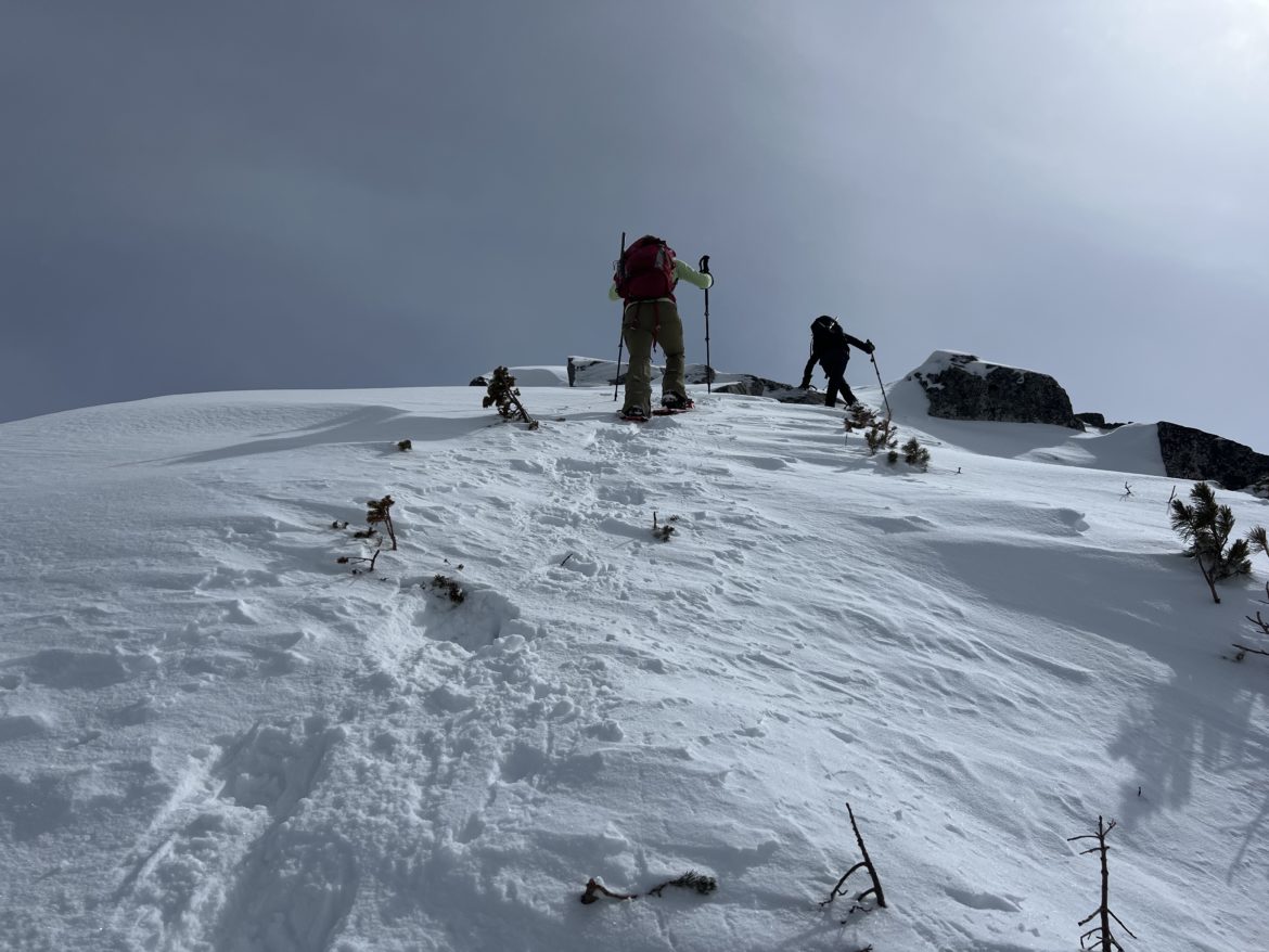
We continued to snowshoe and arrived at the main ridge at about an hour later (12:30pm). We could of went faster but took our time to enjoy the views as we had some clear sky window openings. Once we reached the halfway point of the ridge, we ditched our snowshoes and switched into crampons. The last stretch from there was quite straight forward with some minor obstacles in getting over some slippery rocks.
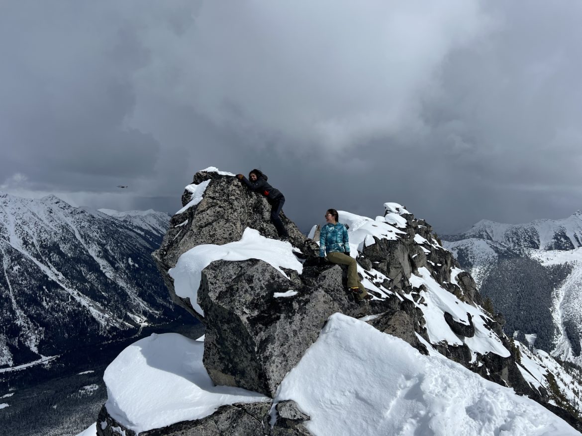
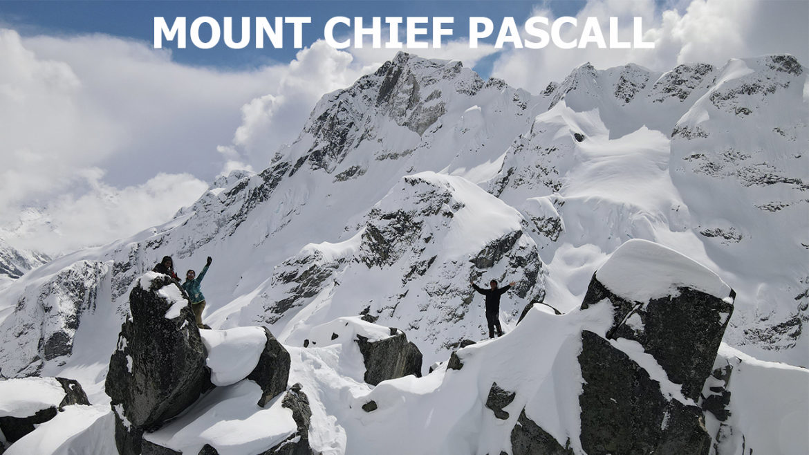
At 1:30pm, we reached the summit of Mount Chief Pascall. At that time, the clouds rolled out and we had some clear skies. We indulged the incredible views, ate our lunch while enjoying the scenery, and took lots of photos. We didn’t realize that we spent 1.5 hours at the top as the weather was so nice and the views were just amazing.
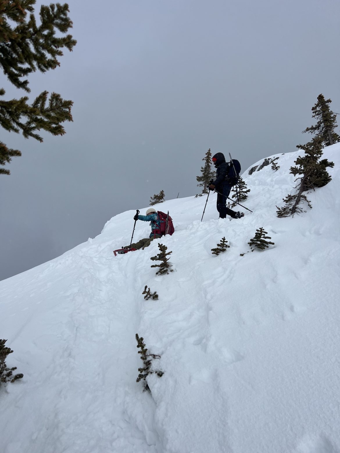
At 3pm, we started to head back down and got back to our car at 6pm. Drove to Pemberton and had a nice meal and beer at Town Square.